Planning in Kenya: Challenges and Roadblocks to Sustainable Growth


Planning in Kenya: Challenges and Roadblocks to Sustainable Growth

EXECUTIVE EDITOR
Prof. Gordon Wayumba
HEAD OF CONTENT
William Kiarie
CONTRIBUTING EDITORS
Gerald Nyanjua Amolo
David K. Njoroge
Christine Wahome
Fridah Omoke
The magazine and related website provide topical overviews and reports on the latest news, trends and developments in geomatics all around the world. Afrospatial is orientated towards a professional and managerial readership, those leading decision making, and has a worldwide circulation.
Afrospatial is available six times per year on a subscription basis. Geospatial professionals can subscribe at any time via https://www.afrospatial.com/subs Subscriptions will be automatically renewed upon expiry, unless Afrospatial receives written notification of cancellation at least 60 days before expiry date.
Information about advertising and deadlines are available in the Media Kit. For more information please contact our marketing advisor: marketing@afrospatial.com
No material may be reproduced in whole or in part without written permission of Afrospatial.
Copyright © 2024,
How AI/ML is Revolutionizing the Conservation of Forests - Pg 4 Obstacles in Land Surveying: Insights into Kenya’s Current Issues - Pg 8
Landscape Architecture in Urban Planning - Pg 14
3D Virtual Tour Insights- Pg18
Latest News In GIS - Pg23
Mapping Africa’s Future: OpenStreetMap Takes Center Stage in Nairobi - Pg 30
Urban Planning in Kenya: Challenges and Roadblocks to Sustainable Growth - Pg 36
3D Mapping - Pg 40
Welcome to another exciting edition of Afrospatial Magazine, where we continue to explore the rapidly evolving landscape of geospatial technologies that are shaping our world.
In this issue, we shine a spotlight on a pivotal moment for Africa’s geospatial community: State of the Map Nairobi 2024. Our main feature, Mapping Africa’s Future: OpenStreetMap Takes Center Stage in Nairobi, offers an in-depth review of the event that brought together geospatial innovators, enthusiasts, and advocates from across the continent. The discussion around OpenStreetMap, and its growing role in democratizing access to geographic data, is redefining how we envision Africa’s development.
But that’s not all. Our pages are filled with articles that explore the cutting-edge evolution of drones and their impact on everything from agriculture to conservation, the role of GIS in urban planning and smart cities, and a collection of the latest industry news that’s stirring conversation in geospatial circles.
As always, Afrospatial Magazine remains dedicated to delivering the latest research, trends, and breakthroughs in the geospatial world. Whether you’re a seasoned professional or just stepping into this fascinating field, we hope this edition offers both insight and inspiration.
Thank you for joining us on this journey to map a better future, and we look forward to your continued support and engagement.
Enjoy your read!

By Christine Wahome
Forests account for 30% of the Earth’s surface and are the primary terrestrial biomes, including almost all terrestrial plants and animal species. Besides protective and environmental services, the forests perform other functions that seem critical for the effective functioning of the planet’s systems; for example, trees; can capture approximately 3/10 of the global emissions of CO2, maintaining the air free of greenhouse gases

They are vital in such a manner that they regulate water distribution, prevent or control pests affecting agriculture, and feed the global population. Also, they offer crucial medicinal plants and power approximately half of the global renewable energy.
They also significantly improve human and ecological preparedness or responses to sudden events such as floods or droughts and simultaneously protect the hydrogeological systems of various ecosystems. Forests primarily support billions of people through tree resources. Unfortunately, some problems affect forests, including forest degradation through factors such as urbanization, agriculture growth, and timber usage worldwide.
In addition, climate change factors like wildfires are worsening the problem of deforestation across the globe. Research also shows that the global decrease in forest and carbon stocks is expected to continue in the foreseeable future. Forests are dynamic in themselves, and their management has to accept this as global administrations struggle to make revolutionary changes in line with nationally established targets and obligations.
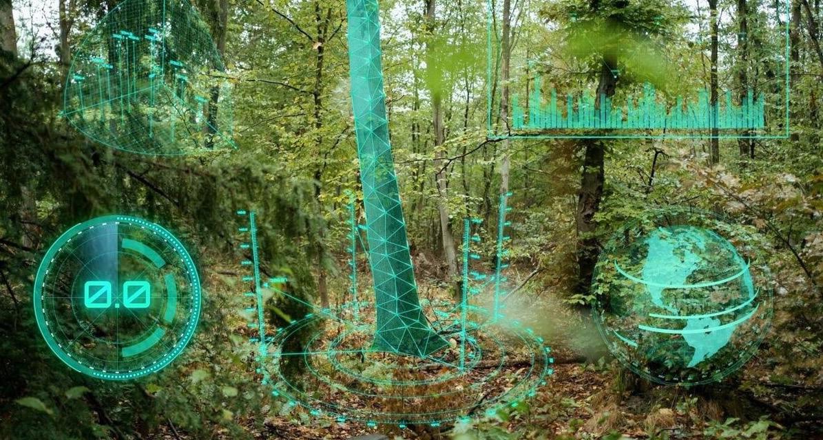
This means that it would be easy for technology to replace techniques for collecting and analysing data, which have many shortcomings and are critical to effective forest management and conservation. The fundamental strength of technology from this perspective is that it encourages innovation and can help with the fast optimization of some or many of these innovations
across multiple contexts and sizes simultaneously, which is a significant advantage for the forest industry.
AI/ML aid conservation and support the retention of our world’s biodiversity. They are capable of creating equipment or devices that improve, mechanize, and expedite activities that human intelligence would otherwise perform. This comprises recognizing oddity, foreclosure, and patterns.
Advanced computation, technology, and research have enabled increased adoption of AI technology in various fields, including forests and species conservation. This increased adoption has been possible for several reasons. First, insight generation and decision-making have been enhanced since information is produced and made available more quickly. Second, owing to the ubiquitous use of cloud technologies, users can quickly test and engage in research using complex solutions at scale.
This results in lower costs as far as computation and data storage are concerned. These developments were founded on the growth of the availability of rounded data that resulted from human-centered data, high-quality satellite images and sensors and telemetry technologies, drone and camera technologies, and so on.
Internationally, the integration of AL/ML algorithms with geospatial analysis is being applied to track deforestation trends. For example, most organizations reveal real-time deforestation mapping and observation through artificial intelligence-embedded interfaces and accessible satellite images.
The responsible authorities can listen to chainsaw sounds or recognize unlawful cars using audio recognition AI systems.
They can then email authorities about the issue at hand on the same device almost instantaneously. Moreover, integrating advanced image technology with daily satellite image datasets obtained from various satellites could provide low-cost satellite datasets to manage natural areas efficiently. Detailed evaluations of the forest structures and enhanced forecasts of the forest stock are observable by GIS data, imagery, climate, atmospheric parameters, and AI.
In addition to forest degradation, deforestation
accounts for more than 10% of carbon emissions. That is why in developed nations, geographical analysis has been synchronized with AL/ML algorithms to track and predict deforestation rates.
For instance, some organizations provide maps of real-time deforestation and observation through intelligence and open-satellite data. In addition, digital intelligence and artificial intelligence (AI) in automation can quickly identify strategic areas for cultivation of diverse plants, launch preprogrammed seeds and nutrients to enhance growth and survival for improved reforestation.
Although 2D and 3D visualization programs and applications have been developing at a breakneck speed recently, CAVE2 imaging technologies as well as sophisticated XR and VR technologies are still infrequently used in simulations of forest conservation.
Pruning, thinning, replanting, and tending are examples of practical forest conservation techniques that are essential for many reasons, including retaining water, preserving the balance of the forest ecosystem, fending off climate change, lowering greenhouse gas emissions, and being windproof. Numerous customized tools for visualizing forests have been developed in the past, including the Virtual Forester, SVS, Balance, and Smart Forest.
These products, nonetheless, lack the sensory input and quantization of the stand disturbance and instead concentrate on building models at the landscape, tree, and stand levels, as well as environmental and topographical elements. The enhancement and functionality possibilities of interactive sensory thinning simulation are usually given little consideration.
Furthermore, it would take years to observe how forest conservation techniques affected the ecosystem or stand composition. At present, by employing smart interactive programs and 3D engines, it is feasible to precisely and thoroughly portray forest development processes and 3D data owing to advancements in AI-based image processing and graphics technology.
For example, real-time structural indices prior to as well as following thinning can be computed by the digital twin (DT). In addition, the DT can estimate individual tree development and show updated forest structure data on the console by integrating a growth model. The forest DT’s whole operating cycle
thus becomes repetitious, totally automated, and demands little human intervention—the foundation for non-biased decision-making input.
Another element of the forestry industry undergoing a change process is collecting inventory data. The climate-sensitive forest sensors have been developed to be connected to the Internet, so the management of forests and conservation activities will be significantly improved by the new methods for accurately collecting and analyzing detailed and accurate data.
These sensors measure temperature, moisture and many other parameters, giving almost real-time information about the state of activities in forests and ecosystems. This information is used to build models for the state of forests and possible threats involving storm damage, water scarcity, diseases, wildfires, pests, soil health, and other calamities. Moreover, the prohibited trade in timber is equally lucrative as the black-market trade in wildlife.
The illegal production and sale of timber cause deforestation, releasing a lot of carbon emissions. In addition, this practice endangers tree species like mahogany, rosewood, and dipterocarps trees. The prohibited trade of timber puts pressure on and cuts global prices by approximately 10%.
Some critical solutions for regulating the wood supply chain against this practice include employing AI technology, space technologies, supply chain mapping, automatic data collection from Earth Observation and the Internet of Things, and blockchain.
Moreover, as the world population rises, there is a rising need for wood and non-wood forest products in the market. Consequently, the sector faces challenges like the intensification of pressures from competition, unpredictable shifts in demand, and supply risk.
As such, researchers are looking into systematic and deliberately developed technologies employing AI algorithms for demand and supply challenges concerning the sector. These technologies focus twofold: on usage of forest resources and conservation of these resources’ sustainability.
Frequently, people research the aspects of forests that contribute to various types of animals living in them, and that is why identifying the efficiency of existing interventions is essential.
The role of AI technology is crucial in these efforts, where the following is a key recommendation: Diverse conservation activities have been designed and implemented to aid in determining the effects of conservation on biological diversity, and to support this research, scholars have developed sophisticated self-contained systems for acoustic monitoring of the ecosystems.
For example, small sound recorders are concealed in diverse places within the forest to study the reaction of animals to nature-caused factors like deforestation and human-caused factors like poaching. Many of these devices record sounds from the forest and analyze them to establish species’ calls and their changes in activity patterns.
A global database has been created to collect the results of projects occurring worldwide and provide analysis tools for these datasets while emphasizing conservation success stories. The applied features of this innovation can be tangible for understanding species’ reactions and the efficiency of actions resulting from the disruption.
For example, some studies have used ML to classify vibration data from approaching trains for timely alerts to avoid fatal runs on wild animals in Canada, principally grizzly bears that fall victim to trains. When the categorizations were programmed into the sound and light signals before the arrival of every train, the scholars noticed that the animals moved out of the tracks hours before their usual time.
Besides, the critical use of visions for detecting wildlife has also led to the extensive implementation of AI automation to identify wildlife species. For instance, a heat- and motion-sensitive camera captures images, which results in a million photo or video shots over a large region. Using AI, this data can be analyzed to identify the various species accurately and also locate them.
Species and individuals must be distinguished in conservation activities to evaluate the biological continuum and manage human-wildlife interactions. For example, farmers can be informed of events where elephants are seen near fields and human settlements using automatic capturing devices and image analysis tools to prevent risks like crop loss, animal attacks, and death.
Moreover, these systems can also recognize specific tigers that become accustomed to contact with people, raising the probability of adverse effects.
Comprehending the relationship between forest management and forest hydrology is critical: surface and sub-surface water pathways, nutrient cycles, and precipitation influences are vital to forest productivity and water quality.
More data about ecohydrological parameters are obtained through better and higher performance of sensors, including GIS technology, smartphones, remote sensing, and self-driving systems. For instance, AI coupled with ML has been applied to determine how forest canopies filter rain, canopy retaining capacity for moisture, variations in the moisture of different areas and at various intervals in mechanical regions, and direct evaporation on a global and local dimensions.
They also facilitate the assessment of vegetation water storage, evaluation of plant water deficit, and vegetation coverage for groundwater. The development of extensive hydrological data in the recent past based on remote sensing and data integration enhanced the use of ML for LSM, where the latter focuses on the investigation of LSM as the water exchange between land and atmosphere, including groundwater. In the past half-decade, AI/ML and big data have helped predict extreme climate conditions, including impacts such as landslides, droughts, and floods relating to forests.
Work has been done to enhance the prognosis of terrestrial eco-hydrologic extremes, including TWS, evapotranspiration, streamflow, and soil moisture over seasonal to decadal time scales through AI technologies. Such technological developments, data, and modeling of these work-in-progress are gradually redefining the hydrological dynamics of forests and watersheds with policy and management implications.
Furthermore, there is significant interest in employing AI and ML paradigms regarding water supply and demand to maintain aquatic and marine species diversity. Forest firefighting and management, erosion and sedimentation effects on rivers, water quality, pollution, toxicology levels, aquatic and marine species distribution, and habitats have been predicted and described using these models.
Prior research indicates that AI will be instrumental in new technologies for conservation plans and in defining risks to water and marine environments. By using these concepts, optimal monitoring and conservation of water resources, aquatic species, and marine life forms will be done efficiently to meet global issues such as efficient water resource utilization, protection of species diversity, and development of accessible, easy-to-manage freshwater and marine systems models.

By David K. Njoroge
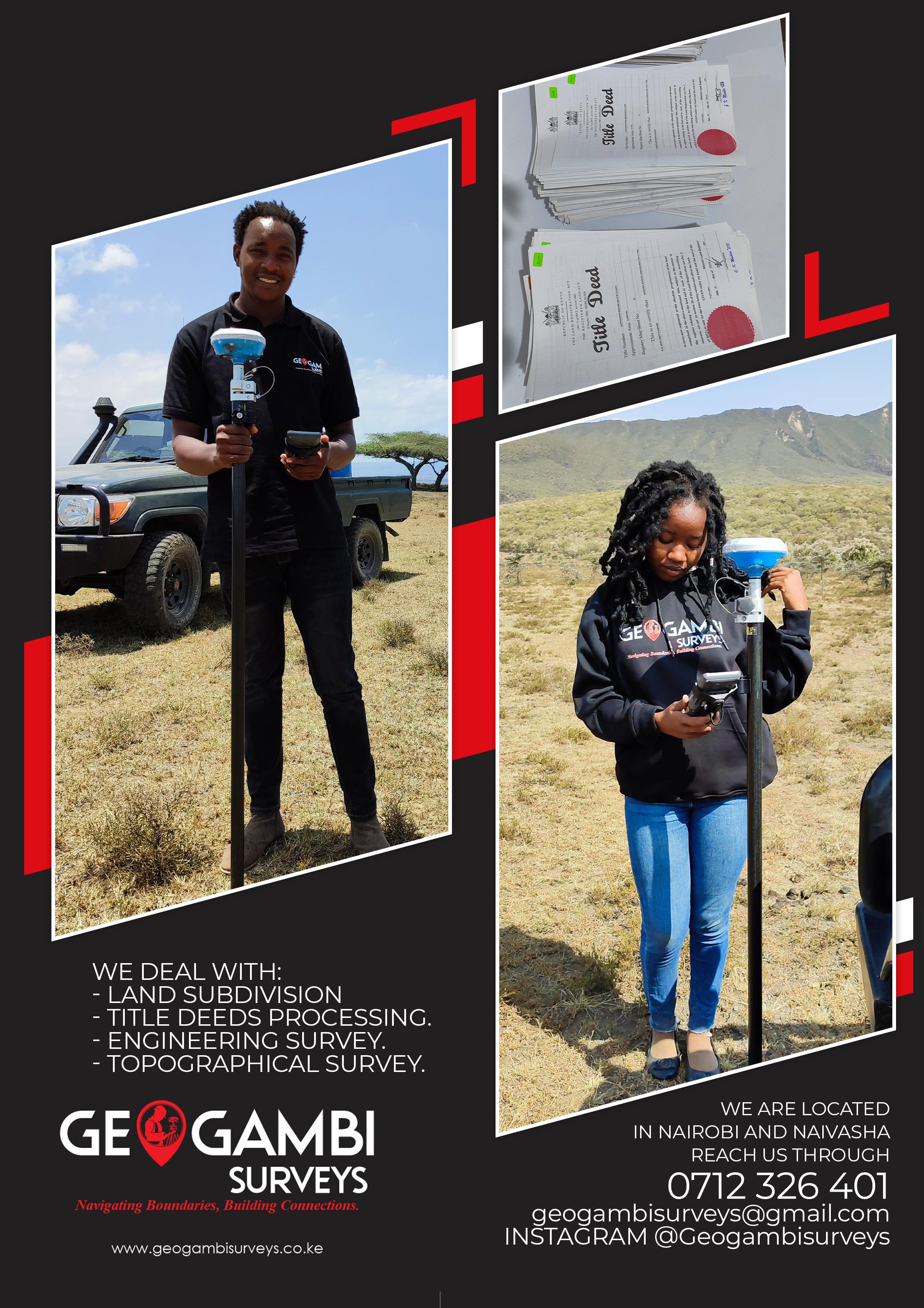
Land surveying in Kenya is critical for sustainable land use, urban planning, and resolving boundary disputes. However, the profession faces several challenges that affect its efficiency and accuracy. These issues are not only technical but also administrative, legal, and socio-economic. Below are some of the key challenges affecting land surveying practices in Kenya
One of the most significant challenges in land surveying in Kenya is the outdated nature of many land records. A large portion of the country’s land registry is based on paper records that are decades old, making it difficult for surveyors to verify ownership or land boundaries accurately. The lack of a digitized system slows down the surveying process, leading to delays in land registration and an increase in land disputes.
Efforts to modernize the system, such as the implementation of the National Land Information Management System (NLIMS), have been slow and face challenges related to data validation and technological adoption.
Land disputes and inaccurate boundaries are widespread challenges in Kenya, primarily driven by unclear land ownership, overlapping claims, and historical land allocation issues. These disputes significantly impact land surveyors, complicating their work, particularly in both rural and urban settings where various social, historical, and development factors come into play.
In rural Kenya, a large proportion of land is inherited or communally owned, leading to vague or undefined boundaries. Traditional land tenure systems, where land ownership is passed down through generations without formal registration, create challenges for surveyors.
Boundaries are often based on informal agreements or natural landmarks that may shift over time. Additionally, some land is communally owned by families or clans, with no formal surveys or title deeds to define individual ownership.
This lack of well-documented and defined boundaries frequently leads to disputes between neighbors, communities, or family members. Surveyors are tasked with determining boundaries for land registration, development, or agricultural use, often in the absence of any formal records. In these scenarios, surveyors may face resistance from local communities, especially if their findings contradict customary or informal agreements. Resolving these disputes can be difficult, as it requires navigating both legal and cultural land-use systems.
In urban areas, the situation is slightly different but equally complex. Rapid urbanization in cities like Nairobi, Mombasa, and Kisumu has resulted in high demand for land, leading to encroachments and unauthorized subdivisions. As the value of urban land rises, property owners, developers, and individuals sometimes resort to subdividing land without following the proper procedures. This can result in plots overlapping with public land or neighboring properties, leading to legal disputes and complications for surveyors who need to map out these areas accurately.
Unauthorized constructions on disputed or unregistered land further complicate surveyors’ work. In some cases, structures are built on contested land or across undefined boundaries, making it difficult for surveyors to accurately map the area or ensure compliance with planning regulations. Encroachments onto road reserves, public land, or neighboring plots can also lead to legal battles, delaying construction projects and requiring costly court interventions to resolve.
A recurring issue in both rural and urban settings is the problem of overlapping claims to the same piece of land. In some cases, different government agencies or local authorities may allocate the same land to multiple parties, especially in regions where land allocation records are outdated or inaccurate. This often results in multiple title deeds or land
certificates being issued for the same parcel of land, leaving surveyors in a difficult position when trying to establish legitimate ownership.
Historical allocation problems, such as land granted by colonial authorities, government resettlement schemes, or politically motivated land allocations, further exacerbate the issue. These inconsistencies create complications for surveyors trying to reconcile historical claims with modern land records and ensure that boundaries reflect current legal ownership.
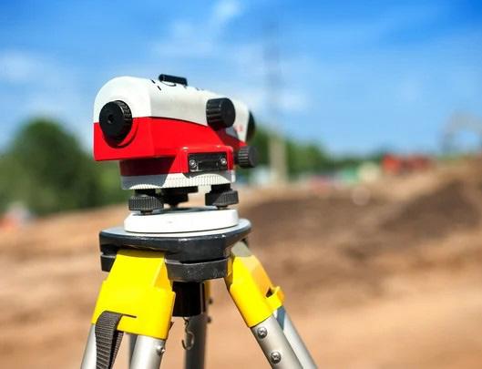
Although technological advancements have revolutionized surveying practices globally, many land surveyors in Kenya continue to rely on outdated equipment. The limited availability and high costs of modern tools such as GPS systems, Total Stations, and drone technology are major barriers to the widespread adoption of advanced surveying techniques.
This issue is particularly prevalent among smallscale surveyors and those operating in remote or rural areas. The combination of cost, training limitations, and lack of access to modern tools hampers the profession’s ability to produce accurate, efficient, and timely results.
While advanced tools like Global Positioning System (GPS) and Total Stations have become standard in many parts of the world, they remain inaccessible to many Kenyan surveyors, especially those in smaller firms or working in under-resourced areas.
These tools provide far more accurate readings compared to traditional methods, and their use can significantly reduce time spent in the field. However, the high initial cost of acquiring modern equipment, combined with maintenance expenses, deters many professionals from investing in them.
Moreover, drone technology, which offers a more efficient and cost-effective way to survey large areas, is still in its early stages of adoption in Kenya. Drones can provide detailed aerial maps and 3D models, allowing surveyors to capture data in difficult-to-access areas. However, the technology is expensive and subject to regulatory restrictions regarding airspace usage, limiting its widespread implementation. Surveyors in remote areas, where the terrain is difficult and traditional methods are less effective, suffer the most from the lack of these modern technologies.
The high cost of acquiring modern equipment is compounded by the lack of training opportunities for many Kenyan surveyors. Even when these tools are available, many surveyors may not be familiar with their use, as they may not have received sufficient training in the latest surveying technologies. This skills gap makes it difficult for surveyors to fully capitalize on the potential of tools like GPS, drone mapping, or Geographic Information Systems (GIS), which require specialized knowledge to operate effectively.
In addition to the equipment itself, maintaining modern surveying tools is another challenge. The equipment often requires regular servicing, calibration, and software updates, all of which come at a cost that can be prohibitive for small or independent surveying firms. Without proper maintenance, the accuracy and reliability of these tools can be compromised, making them ineffective for precise land measurements.
The reliance on outdated equipment means that many surveyors are unable to produce the highprecision data required for modern land use planning and development projects. Traditional methods, such as using compasses and measuring tapes, are not only time-consuming but also prone to errors. These inaccuracies can lead to poorly defined boundaries, overlapping land claims,
and conflicts over property ownership. In large infrastructure projects, such errors can delay construction and increase costs as developers attempt to resolve boundary disputes or rework plans based on more accurate data.
For instance, urban planning in rapidly growing cities like Nairobi and Mombasa requires detailed and accurate data to ensure the effective development of roads, housing, and public utilities. Without access to modern surveying equipment, surveyors are often unable to meet the demands of such large-scale projects, leading to delays and inefficiencies in urban development.
In rural areas, where land boundaries are often less formalized, the use of outdated equipment exacerbates land disputes and creates challenges for agricultural planning and infrastructure development. Surveyors working in these regions face additional logistical challenges, such as difficult terrain and lack of access to basic infrastructure, further complicating the surveying process when modern tools are unavailable.
To improve the accuracy, efficiency, and reliability of surveying practices in Kenya, greater investment in modern surveying tools and training programs is essential. By providing surveyors with the latest equipment and ensuring they are properly trained to use it, the profession can overcome many of the challenges it currently faces. Additionally, lowering the cost of acquiring and maintaining these tools, perhaps through government subsidies or partnerships with private companies, could help small-scale surveyors and those in remote areas adopt modern technology.
Furthermore, incorporating the use of digital platforms like GIS into land records management systems would allow for better coordination between surveyors, government agencies, and developers, ensuring that land data is both accurate and easily accessible.
Corruption within land management institutions remains a persistent issue in Kenya. Surveyors often face delays and frustrations when dealing with government agencies responsible for land registration and approval processes. Bribery and
favoritism in land allocation and registration can undermine the credibility of land surveyors and lead to inaccurate data being recorded in the official land registry.
Additionally, navigating bureaucratic procedures, particularly when dealing with public land or land owned by multiple stakeholders, creates further delays in the surveying process.
Kenya is undergoing rapid urbanization, particularly in major cities such as Nairobi, Mombasa, and Kisumu.
This urban growth is driven by factors such as population increase, rural-to-urban migration, and economic development. As more people move to cities in search of employment, better infrastructure, and higher living standards, the demand for land for housing, commercial developments, and public infrastructure has surged, placing immense pressure on land surveyors.
The skyrocketing demand for land in urban centers has significantly increased the need for quick and efficient land surveying. As cities expand, surveyors are required to demarcate plots for residential, commercial, and industrial development at a rapid pace. However, this rush to meet demand often leads to mistakes in surveying processes. Errors such as inaccurate measurements, overlapping boundaries, and poorly defined plots can occur due to the pressure to deliver results quickly.
Moreover, the limited availability of land within city limits means that developers often resort to using smaller plots or reclaiming marginal land, further complicating the work of surveyors. The challenge is to ensure that the land is surveyed accurately
and that the boundaries reflect both legal ownership and safe land use practices. In some cases, land fragmentation due to subdivision into smaller plots reduces the efficiency of large-scale surveys and complicates infrastructure planning.
Rapid urbanization also often leads to poor land use planning. With urban growth happening faster than regulatory frameworks can adapt, some areas experience unplanned developments, leading to land-use conflicts. For instance, residential areas may encroach on land reserved for public utilities, roads, or commercial purposes. Such encroachments are common in informal settlements, where land is developed without adhering to zoning laws.
Surveyors are caught in a delicate position, trying to balance the need for quick land demarcation while ensuring adherence to zoning regulations and land-use plans. This is especially problematic in informal urban settlements, where residents often claim land through squatting or informal agreements, leading to legal conflicts when the land is officially surveyed for future developments.
Another challenge tied to urbanization is land fragmentation, where large plots are subdivided into smaller parcels to meet the growing demand for individual housing or business units. This fragmentation often leads to irregular and poorly planned developments, complicating efforts to carry out large-scale land surveys or infrastructural projects such as roads, drainage systems, and public utilities. The irregular shape and size of these subdivided plots make it difficult for surveyors to create cohesive maps or implement long-term urban plans.
For example, in Nairobi, areas like Eastlands and Kibera face significant issues with land fragmentation, where informal settlements have developed without structured planning, further straining public resources and infrastructure. Surveyors tasked with working in such areas must contend with a disorganized landscape that often lacks proper documentation, making accurate land surveys more challenging.
With urbanization occurring at such a fast pace, surveyors are often expected to work within tight timelines, especially for large development projects. These time constraints can result in the use of incomplete data, rushed fieldwork, or overlooking crucial elements of land-use planning. Resource limitations, such as a shortage of modern surveying equipment or access to up-to-date land records, further compound these challenges, leading to inaccurate results and costly errors.
In fast-growing cities like Nairobi, infrastructure development must keep up with population growth, but with limited time and resources, surveyors
often face the difficult task of completing surveys without the necessary tools or data. The rush to complete projects on schedule can compromise the quality of surveying work, affecting both land development and future urban planning.
Kenya’s diverse landscape presents unique challenges for land surveyors, particularly in remote or rugged areas. Surveying in regions with steep terrain, forests, or national parks can be difficult and time-consuming. Adverse weather conditions, such as heavy rains or extreme heat, can also hinder fieldwork. In areas prone to flooding or landslides, frequent changes in land features complicate surveying efforts, requiring repeated surveys to update boundaries and topographic data.
While Kenya has enacted several laws governing land and property, such as the Land Act and the
Sectional Properties Act, significant gaps in the legal framework continue to affect land surveying practices. These gaps manifest in various ways, particularly in the areas of resolving historical land injustices and clearly defining the role of surveyors in dispute resolution.
Kenya has a long history of land injustices, stemming from colonial dispossession, postindependence land allocation issues, and ethnic conflicts over land. While the National Land Commission (NLC) is tasked with addressing these injustices, the legal framework lacks clear guidelines on how surveyors should participate in resolving these disputes. Surveyors often play a crucial role in determining the rightful boundaries and ownership of contested land, yet there is no standardized process for their involvement in legal or conflict-resolution proceedings.
Moreover, many land disputes, particularly in marginalized rural areas, involve unregistered land where boundaries were never clearly demarcated or recorded. Surveyors are frequently called upon to provide clarity, but the absence of clear laws governing land adjudication, especially in areas without formal title deeds, complicates the process. This results in delays in resolving disputes, leaving landowners in legal limbo.
The role of surveyors in land disputes is often poorly defined within the legal system. While surveyors are trained to provide accurate boundary demarcations, their findings are sometimes disregarded in legal proceedings, particularly in cases where local customs or political interests conflict with formal surveying results. This undermines the authority and objectivity of the profession.
There is also a lack of integration between surveyors and legal institutions in Kenya. For instance, courts sometimes lack technical expertise in interpreting survey reports, leading to inconsistent rulings in land disputes. A more robust legal framework that clearly outlines the responsibilities of surveyors and ensures their technical findings are given proper legal weight would help streamline land dispute resolutions.
c) Inconsistencies Between National and County Regulations
The devolution of land management to county governments introduced new challenges in the legal framework governing surveying. In many cases, there are inconsistencies between national land laws and county-level regulations, which can complicate surveying processes. For example, national laws may provide guidelines on land subdivision, but counties may have additional or conflicting rules on zoning, land use, and approval processes. This creates confusion for surveyors, developers, and landowners, especially in rural and marginalized areas where county governments often lack the resources or expertise to effectively implement land laws.
Furthermore, surveyors working across different counties face challenges navigating varying regulatory requirements, leading to delays and inefficiencies in land surveying and development projects. Harmonizing national and county regulations and establishing clearer legal standards would reduce these inconsistencies and improve the overall efficiency of land surveying in Kenya.
One of the significant challenges affecting land surveying in Kenya is the issue of inadequate compensation for surveyors. Despite the crucial role they play in land management, urban planning, and dispute resolution, surveyors often receive low wages compared to other professionals in the real estate and construction sectors. This lack of fair compensation can be attributed to a combination of factors, including undervaluation of the profession and the inconsistent enforcement of payment standards.
In many cases, surveyors, especially those working in rural areas or on small-scale projects, are underpaid for their expertise and the equipment they must maintain. This discourages talented individuals from pursuing or remaining in the profession and reduces the quality of services provided, as surveyors may feel pressured to cut corners to make ends meet. Moreover, inadequate compensation often leads to delays in project completion, as surveyors might deprioritize tasks that offer minimal financial returns.
Additionally, the lack of public awareness regarding the importance of surveying exacerbates this issue. Many landowners and developers fail to appreciate
the precision, skill, and technical knowledge required for surveying, treating it as a secondary task rather than a cornerstone of successful land use and development. This undervaluation not only demoralizes surveyors but also perpetuates a cycle where survey work is marginalized in project planning and budgeting.
A related challenge is the prevalence of nonprofessionals practicing land surveying. Due to the lack of proper regulation and enforcement, some individuals without formal training or professional certification engage in land surveying activities. This often results in substandard work, inaccurate measurements, and the exacerbation of land disputes.
Non-professionals may charge lower fees, undercutting qualified surveyors and making it difficult for professionals to compete. However, their lack of expertise often leads to flawed surveys, which in turn cause legal complications, boundary disputes, and even financial losses for landowners and developers. Inaccurate surveys can delay construction projects, invalidate property boundaries, and cause conflicts that require costly legal interventions to resolve.
This practice not only tarnishes the reputation of the surveying profession but also contributes to the perception that surveying is not a specialized field requiring extensive training. To address this issue, stricter regulatory measures need to be enforced to ensure only licensed and qualified individuals can offer surveying services. Moreover, public education campaigns could help highlight the risks of hiring unqualified surveyors, while promoting the value of professional surveyors in ensuring accurate land management and development.
Land surveying in Kenya is a vital profession, but it faces several challenges that hinder its effectiveness. From outdated records and limited technology to rapid urbanization and bureaucratic hurdles, surveyors must navigate a complex environment to deliver accurate and timely results. Addressing these challenges requires coordinated efforts from the government, private sector, and educational institutions to invest in technology, update legal frameworks, and enhance training and professional development for surveyors.
By Gerald Nyanjua Amolo
1. Land Use Planning: How to organize the land use for residential, economic, industrial and recreational activities to formulate a dynamic and operational city environment.
2. Transportation Systems: Creating resilient transportation infrastructure that comprises roads, railways, bike paths, and walking trails is imperative for fostering mobility and connectivity in urban environments.
3. Infrastructure Development: Circulating strategies for vital services comprising the water supply, sewage systems, energy grids, and communication networks that promote urban growth and our daily living.
Urban Planning can be simply defined as the process of designing and managing the physical, social and economic development of Urban areas or the Planning and administration of the physical growth and development of human settlements such as cities, towns amongst others. Key elements of Urban Planning include:
4. Housing and Community Development: Providing enough housing for multiple incomes and supporting appropriate housing solutions while creating lively and inclusive communities.
5. Environmental Sustainability: Consolidating ecological spaces, supporting energy thrifty infrastructure, and controlling waste and water resources to reduce the ecological impact of urban growth.
6. Urban Renewal: Revitalizing established urban areas that are losing vitality through redevelopment and reinvestment efforts, designed to improve conditions for living, create economic opportunities, and enhance the overall urban
shape.
7. Public Spaces: Ordering parks, plazas, and recreational spaces so they enhance community involvement and develop the quality of life in urban contexts.
Developing enduring strategies for urban planning is the goal, which ensures that cities can maintain their livability, sustainability, and resilience during upcoming challenges.
On the other hand, Landscape Architecture combines the elements of art and science to generate sustainable, usable, and beautiful outdoor environments. The process of designating the layout of land, water, vegetation, structures, and other features to improve both urban and rural environments occurs within this framework.
The Key aspects of landscape architecture include:
1. Site Planning: Investigating the natural elements of the land and applying them to create practical spaces including parks, campuses, or neighborhoods.
2. Environmental Sustainability: Designs that emphasize ecological awareness will feature green infrastructure, storm water management, and an increase in biodiversity.
3. Urban Design: Improving cityscapes by generating public spaces, streetscapes, and greenways that build community engagement and elevate the quality of life.
4. Recreational Areas : To improve leisure and wellbeing, areas such as parks, gardens, playgrounds, and sports fields started to develop.
5. Restoration: Restoring ecological balance by means of upgrading natural landscapes and reclaimed industrial land.
In their work, Landscape Architects typically address projects that incorporate urban parks and plazas along with residential gardens and the endeavors of environmental restoration. The designs they produce are fundamental in molding sustainable and healthy areas for people and nature.
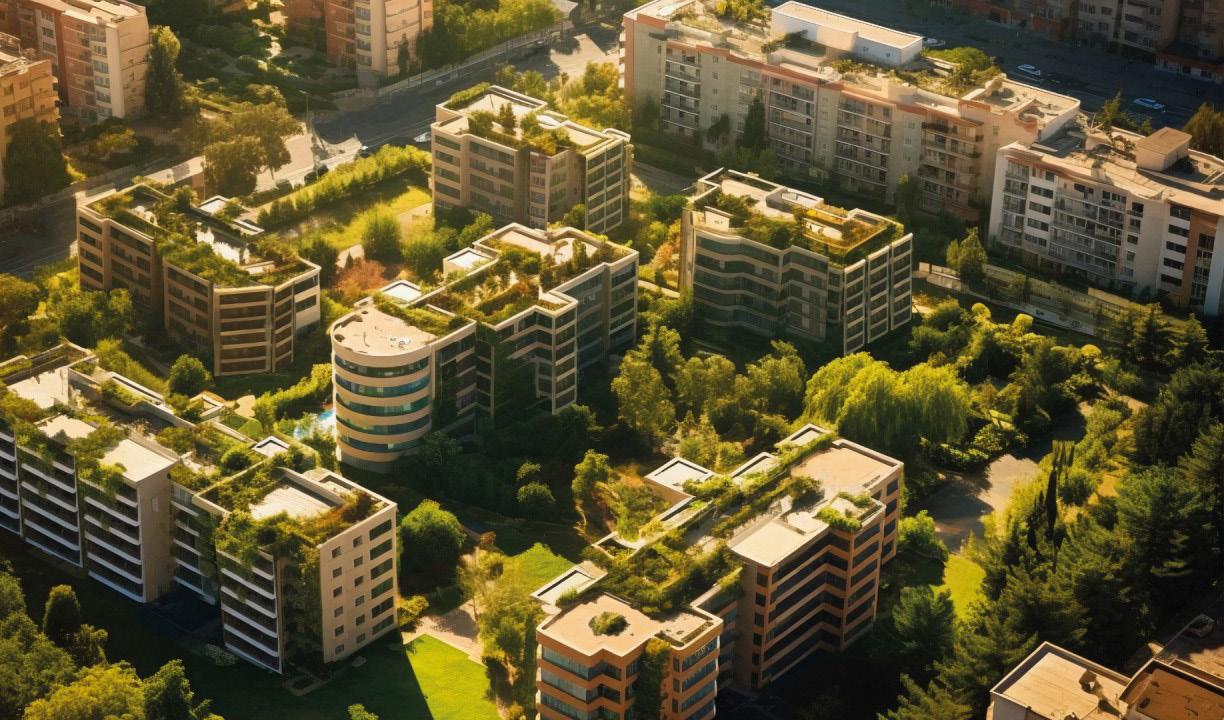
In this context, Landscape Architecture contributes significantly to Urban Design and creation of sustainable and habitable environments. While it is not limited to, creating landscapes such as parks and gardens, and connecting the built environment with nature for ecological purposes, beauty, and health. As urbanization advances, there is a demand for effectively designed areas to respond to the ecological, social, and economic issues.
As a specialization in Urban Planning, Landscape Architecture has close connections with Architecture, Environment and Civil Engineering. Landscape Architecture focuses on making sure that the spaces that are created in urban settings are not only pragmatically useful, but also visually attractive and sustainable whenever possible.
This is realized by designing green spaces, controlling storm waters, enhancing air quality, and providing recreational facilities. Landscape Architects, as designers of livable physical environment, shape more sustainable cities through integration of natural elements into infrastructure systems.
Another area that has largely benefitted from the profession of landscape architecture is the creation of open spaces. Parks, gardens, and urban forests are important lungs in urban areas and should be given significant importance. These green areas offer playgrounds for people and home the wildlife, contribute to the quality of air, and reduce the impacts of the heat island.
Well-known parks like Central Park in New York City and Hyde Park in London perfectly demonstrate how properly and efficiently arranged gardens can help improve the inhabitants’ quality of life in large cities. Furthermore, the use of vertical and rooftop gardens is relatively new and unique in areas of the city where horizontal space is scarce. These green roofs and walls enhance aesthetics within the urban fabric and have functions as an insulator, storm water manager, and a species provider.
As populations increase, sealed surfaces such as concrete and tarmac become more and more common: runoff occurs more readily and flooding is more likely to happen. These aspects are tackled head-on by landscape architects who integrate sustainable drainage systems, permeable pavements and bio-swales in representing the physical environment.
They are useful for handling storm water, mitigating flood hazards, and enhancing the rate of groundwater recharge. In regions where flooding is a regular occurrence, the landscape architects arrange flood plains, marshes, and water storage reservoirs to manage the intensity of excessive rainfall and rising water levels.
Resilient urban design is also a significant when concerning climate change outcomes. Landscape Architects pro-actively design sustainable methods by which these cities are able to manage for such occurrences that will not harm the natural ecosystems.
Landscape architectural approaches such as the Copenhagen and Singapore adaptations and strategies that consider the resilience of the urban green and landscape have been adopted in cities such as Copenhagen and Singapore for the resilience to flooding and other impacts of Climate Change. The integration of sustainability in the urban design is a new goal for the cities globally, and Landscape Architecture has been on the frontline of this change. Landscape Architects contribute to environmental health through designing spaces that can create a low carbon city and support biodiversity.
Another area where the profession plays a pivotal role is the consideration of diversity in the city’s
landscape. They create such environments that are favorable to planting indigenous species and the local wildlife, thus fostering the kind of environment that may otherwise be dominated by concrete and steel structures.
Urban ecosystems, for example, generate services like pollination, pest control, and air purification, among others. Underpasses, overpasses, and revitalized rivers are examples of how landscape architects can reconnect fragmented habitats with urban environments. It not only promotes local conservation but also gives many residents a chance to interact with nature regularly, helping people become more eco-friendly.
Landscape helps make cities energy efficient as elements of landscape act as barriers to the use of energy. For instance, trees and shrubs can prevent wind from blowing through the building, save energy on heating in winter, and provide shade, thus reducing the amount of energy required to cool the building in summer. Other green infrastructure like urban forests, green walls, and green roofs also play a role in carbon storage, thus lowering the carbon footprint within cities.
This indicates that Urban Planning is not only about designing efficient urban environments, but is also about the welfare of the people who live in those environments. Landscape Architecture is beneficial to physical and mental well-being as it enhances the places where we exercise, rest, or meet other people. Green areas are claimed to describe stress, promote physical activity, and facilitate the interaction of people. Overcoming Sleeplessness.
Easy access to well-planned parks, playgrounds, and recreation facilities promote an active life which is significant in preventing diseases such as obesity and heart disease. In addition, contact with natural environments can help alleviate stress, anxiety, and depression. Thus, landscape architects use the method of integration of natural elements and the living environment to create suitable spaces for the human mind.
Public green spaces also provide places for social contact where many and varied people are assembled and therefore create togetherness. High-quality parks, squares, and walkways create areas for public functions, festivals, cultural events, and other informal meetings. Through creating welcoming and engaging public spaces as defined by access, landscape architects foster unity within cities.
However, there are several challenges associated with the application of landscape architecture in urban planning. Various challenges such as tight financial resources, limited space, and multiple demands sometimes prevent the actualization of Landscape Architectural projects in their entirety. In addition, the fast rate of growth of urban centers is placing tremendous pressure on resources hence development and preservation struggles.
Finally, considering the future perspectives, it becomes essential for Landscape Architects to think creatively and actively address the modern needs of cities. Population, climate change, and technology will influence the future of Urban Planning.
Landscape Architects will need to design new strategies for constructing environmentally friendly, resistant, and accessible urban environments. The development of smart cities with interconnected technologies may present new challenges for Landscape Architects and allow them to maximize the positive impact of green space.
Landscape Design has a perfect right to be considered as one of the branches of Urban Planning that has the primary responsibility for the functional and social aspects of cities and their residents. Landscape Architects embrace sustainable designs, social aspects, and links of green areas that enable the development of lively, healthy, and sustainable urban atmospheres.
It remains worth pointing out that the role of landscape architecture in further development of sustainable urban environments will be even more relevant in the future.
By Fridah Omoke
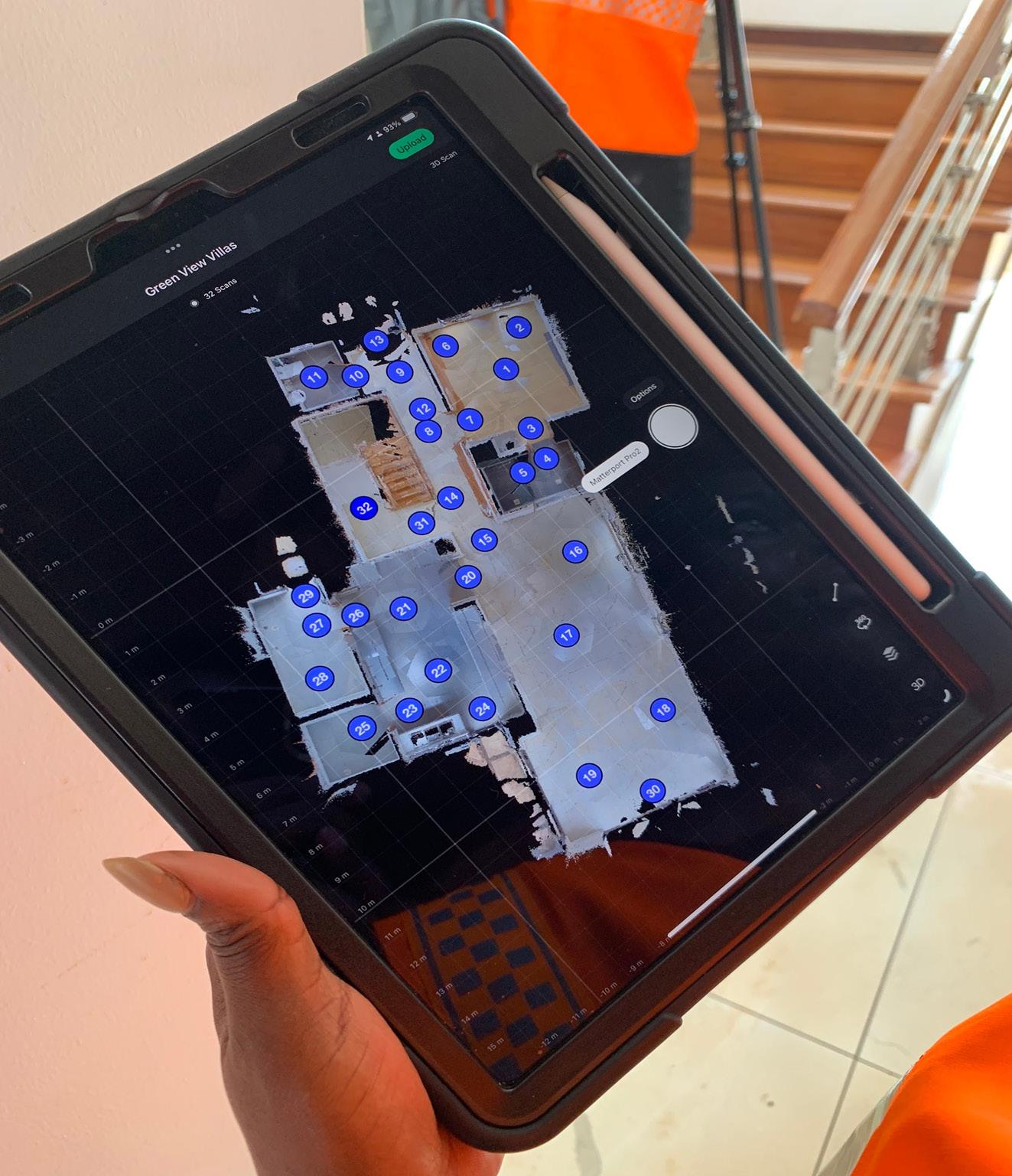
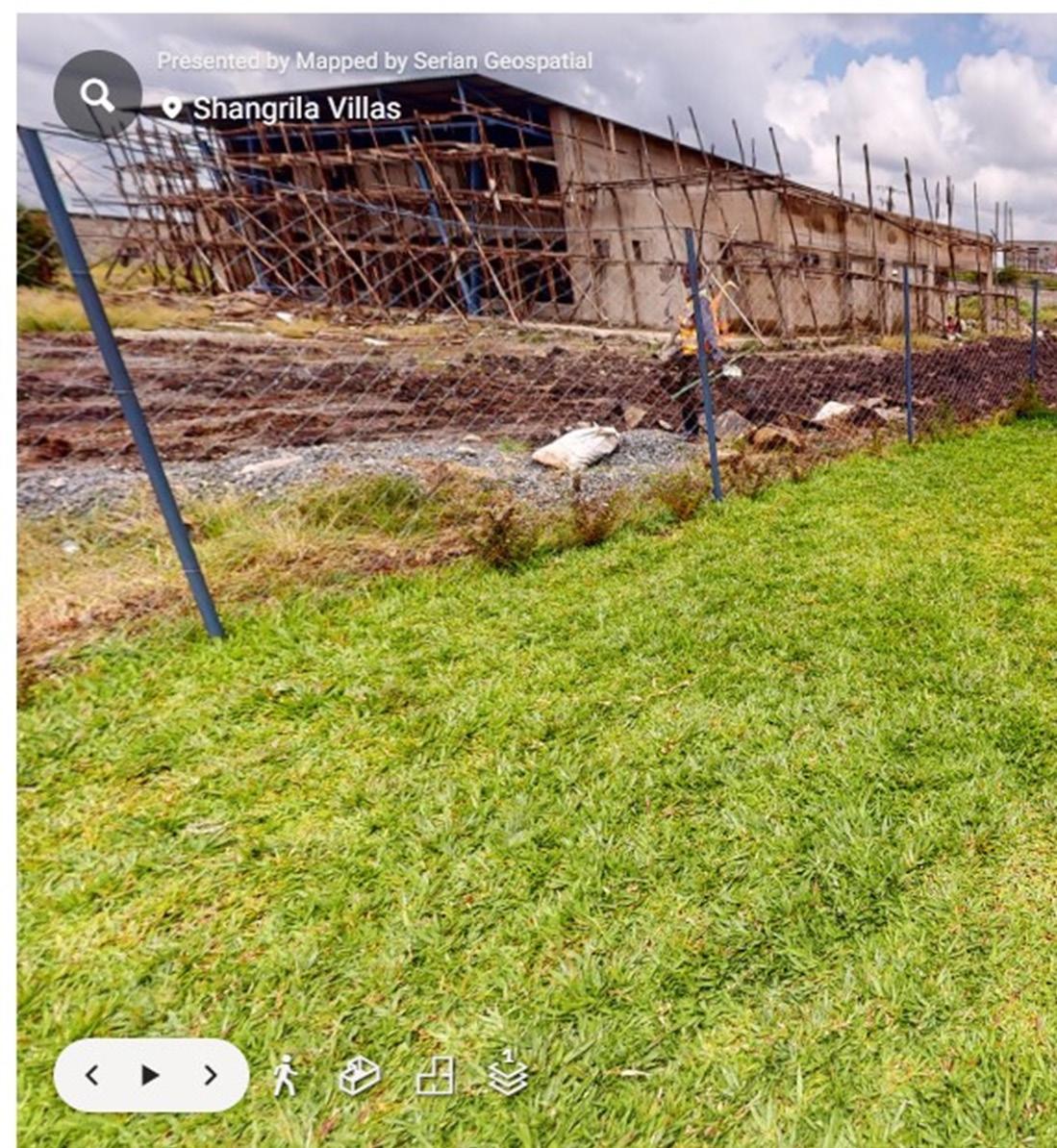
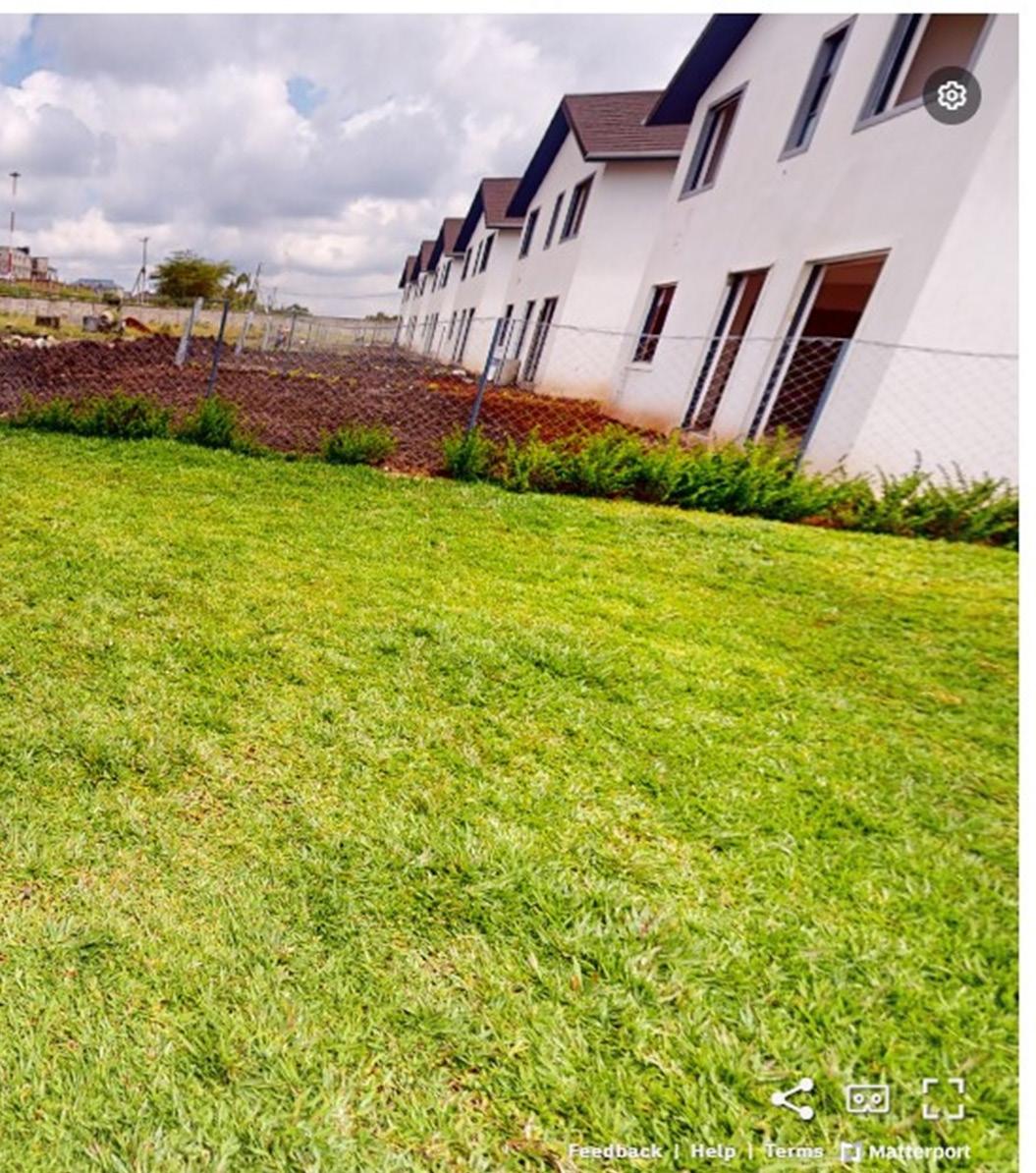
Advances in geospatial mapping and 3D virtual tour technology are propelling the real estate business, as well as other industries dealing with property and land management, through a transformation.
These techniques, notably those offered by Matterport cameras such as the Pro2, Axis, and Pro3, have brought an immersive and interactive approach to property marketing, exploration, and analysis. By combining highquality 360-degree views with geographical data, these virtual tours provide consumers with a one-of-a-kind experience that goes well beyond standard real estate listings.
This combination of geographic mapping and virtual tours is transforming not just the way real estate is presented, but also how potential buyers and investors make educated decisions.
Initially, remote property research appeared to be a simple approach to peruse real estate listings from a distance. However, when integrated with geolocation data, 3D virtual tours have even more potential. These virtual models may accurately depict the real environment using high-resolution images and spatial information such as LiDAR and Geographic Information System (GIS) data.
This is especially important in real estate and property management, where knowing the larger geographic context—such as proximity to infrastructure, environmental conditions, and zoning regulations—is critical for making sound investment decisions.


In the world of real estate, 3D virtual tours are more than just a visual tool for displaying properties. They provide a data-rich, interactive experience that allows users to visually traverse properties and access critical levels of geographical information. Unlike standard 2D photos or floor plans, these tours allow purchasers to navigate a home in real time, analyzing everything from the architectural arrangement to environmental data. By connecting Matterport cameras with GIS systems, every detail of a property is recorded with exceptional clarity, uniting the physical and digital worlds.
These virtual tours go beyond just displaying a home’s interior. They provide potential purchasers with information on the area, closeness to amenities, and even environmental dangers like flood zones or soil stability. A 3D virtual tour delivers a complete image by including geographical data, allowing viewers to estimate the potential worth and dangers connected with a property. This additional background is especially useful for customers who are unfamiliar with the area or are making long-distance purchases.
The combination of geospatial mapping and 3D virtual tours dramatically improve property visualization. Buyers and real estate professionals may now experience a house in a completely immersive, three-dimensional environment, rather than just flat photographs. This not only offers a better knowledge of the property’s dimensions, but also allows people to visualize how the space flows and works.

Furthermore, geographical data may be integrated into these virtual tours, providing useful context. GIS overlays, for example, can show the position of a property in relation to schools, public transit, and commercial centers.
Topographical data can assist determine whether the property is in a flood-prone location or on uneven ground. This expanded visualization provides purchasers with a thorough grasp of not just the property but also the surrounding surroundings, which is essential for making informed investment decisions.
Another significant benefit of merging 3D virtual tours with GIS mapping is the incorporation of real-time data layers. This tool provides property buyers and investors with up-todate information about local traffic conditions, weather patterns, and neighboring development
projects that may impact property value or quality of life. For example, a virtual tour of a suburban community may incorporate real-time updates on public transit routes, school zone boundaries, and environmental dangers.
This real-time data enhances the virtual tour experience, changing it into an insightful decision-making platform. Investors can assess a property’s immediate surroundings and learn about prospective future expansions or infrastructure enhancements. Real-time mapping is especially useful in real estate markets because factors such as urban growth, environmental conditions, and transportation infrastructure may quickly alter the value and appeal of properties.
In real estate, precision and accuracy are essential for property marketing and assessment. The combination of 3D virtual tours with geospatial technologies such as GIS and LiDAR guarantees that virtual models are not only immersive, but also extremely precise. Because of their precision, these tools are invaluable for appraising big properties, land projects, and commercial spaces where the finer nuances of property borders, zoning restrictions, and environmental conditions must be carefully examined.
A commercial real estate developer, for example, may utilize a 3D virtual tour to envision a planned shopping center in relation to its surroundings.
By including zoning rules and property boundary data into the virtual tour, the developer may determine if the project meets local standards and how it will affect surrounding companies or traffic flow. This precision is critical for making educated decisions early in the development phase, preventing costly mistakes and regulatory concerns later on.
For developers, urban planners, and real estate investors, 3D virtual tours are an effective tool for assessing future projects and managing existing assets. These virtual environments enable stakeholders to see how new projects will interact with existing infrastructure, transit networks, and natural surroundings. By including geographical data, 3D virtual tours may demonstrate how a property or development fits into its larger geographic context, assisting in anticipating future obstacles and possibilities.
For example, in large-scale developments such as residential communities or shopping malls, virtual tours might incorporate geographical data layers such as utility lines, traffic patterns, and environmental laws. Stakeholders can test multiple scenarios to evaluate how different elements, such as increased traffic from a new development or environmental concerns, would affect the surrounding neighborhood. This capacity to mimic future situations is extremely useful for reducing risks and increasing the success of real estate ventures.
The combination of 3D virtual tours and geospatial mapping is altering how we see and interact with real estate sites. From a geospatial standpoint, these tours provide more than just a thorough look at a property; they also provide a rich geographical context that might impact purchase choices.

Buyers can research aspects such as proximity to crucial services, neighborhood growth potential, and environmental dangers, all of which are important considerations when buying in real estate.

In addition to offering rich visualizations, the incorporation of geographical layers enables users to investigate a property’s larger context in relation to its surroundings. For example, a 3D tour of a seaside property may include interactive maps of erosion concerns, flood zones, and local natural preserves, providing a more indepth understanding of the possible problems and rewards of owning the land.
This immersive experience improves user engagement. Prospective buyers may see their prospective home in the context of the surrounding area, assessing everything from walkability to local amenities. For real estate brokers, developers, and investors, the combination of 3D visualization with geographical data provides a more engaging and informative approach to display properties and make data-driven choices.
The combination of 3D virtual tours with geospatial mapping is transforming the real estate market and other fields involving land and property management. These technologies provide new methods to interact with and understand properties by improving data visualization, including real-time information, and offering precise, immersive experiences. Matterport technology, paired with GIS and LiDAR data, has altered how buyers and investors evaluate property value and make decisions.
As these technologies advance, their impact on real estate and property management will only increase. The ability to visually tour a property while obtaining key geographical data in real time gives a holistic picture that benefits both buyers and investors. Whether considering a tiny residential property or a huge commercial complex, 3D virtual tours paired with geospatial mapping are paving the way for better, more informed real estate decisions.
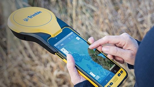
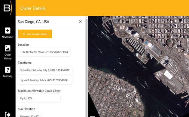
Trimble has introduced the Trimble TDC650 handheld, a high-performance data collector designed for GIS data collection, inspection, and asset management. This rugged device offers scalable, highaccuracy GNSS positioning for fieldwork. Fully integrated with GIS applications, it uses the Trimble Software Development Kit (SDK) to provide precise positioning with apps like Esri ArcGIS Field Maps and Trimble TerraFlex. The TDC650 also allows users to select the accuracy level they need, down to the centimeter, to fit both their needs and budget.

ArcGIS IPS has introduced a new technique in GIS called indoor positioning system. This technique helps you find yourself and others inside a building in real time. Like GPS, it shows a blue dot on indoor maps and guides you to any point of interest. It enables real-time navigation, location sharing, and tracking, making it easier for customers, visitors, and contractors. It also streamlines indoor data collection for mobile workers and provides analytics to boost efficiency and enhance customer service.

Siemens Smart Infrastructure has teamed up with Esri, a leader in GIS and location intelligence, to enhance its grid software ecosystem. This partnership combines Esri’s advanced mapping and spatial analytics with Siemens’ expertise in electrical systems. Together, they aim to improve planning, operations, and maintenance of power networks, streamline data flow between applications, and support better integration of Distributed Energy Resources (DER) to help achieve net zero faster.

Prague’s Institute of Planning and Development (IPR) has recently won a top global award from Esri, a leading GIS software provider. This prestigious honor recognizes Prague’s effective use of data in urban planning and addressing climate change. The city was especially praised for turning data into green and economic solutions that enhance the quality of life for residents and visitors.
The 5th GIS Software Technology Conference (GTC 2022) has concluded, marking a major global event in GIS. Co-organized by FIG, SaudiGS, CLAERIA, ASPG, and SuperMap, the conference took place from July 6-8 and brought together experts, officials, and representatives from nearly 130 countries to explore the latest SuperMap GIS technologies, discuss innovative GIS applications, and examine future industry trends.

The countries below are among those that took part in the conference:
On July 12, at the Esri User Conference in San Diego, BlackSky and Esri introduced a new feature called BlackSky Tasking on Esri’s ArcGIS Online platform. This cloud-based tool allows users to control satellites and receive imagery directly within ArcGIS Online.
As of September 2024, Kenya has seen notable advancements in the GIS and geospatial sector, particularly in agriculture, forestry, and land management. GIS technology for instance UAVs is being utilized to enhance agricultural management, with organizations like the World Resources Institute (WRI) using it to map land cover, livestock densities, irrigation, and crop productivity. This aids in promoting sustainable land use and improving agricultural output.
In the forestry sector, the government has integrated GIS to track progress in the 15 Billion Tree Growing Initiative, aimed at restoring degraded landscapes and achieving 30% forest cover by 2032. GIS helps monitor forest cover changes and aids in planning reforestation efforts.

The Kenya Open Data Initiative (KODI) has expanded its geospatial data catalog, covering sectors like education, health, infrastructure, and land management. Platforms like KODI are improving access to important datasets, helping stakeholders make better decisions in urban planning, conservation, and disaster risk management.
Projects like the National Spatial Data Infrastructure (NSDI) and the National Land Information Management System (NLIMS) are digitizing land records, providing real-time spatial data access for public services. These
systems enable secure digital title deeds and land management via platforms like the eCitizen portal.
As of September 2024, Botswana is advancing its GIS and geospatial technologies, particularly in land management and natural resource monitoring. GIS plays a vital role in managing resources within the mining and agriculture sectors, while also aiding in environmental management by tracking water resources and drought conditions.
Additionally, GIS supports urban planning to address rapid urbanization. The government is collaborating with international partners to strengthen the National Spatial Data Infrastructure (NSDI), improving data accessibility for sustainable development in sectors like health and infrastructure.
One amazing factor in Botswana is that GIS is also incorporated in Primary.
Earlier this month, the GIS Primary students delve into the world of robotics, blending creativity and technology in their cutting-edge lab.

A teacher pictured with his students in the GIS lab:
On Monday, GIS opened its new Science and Technology Centre, along with a new primary school building, a preschool, and upgraded facilities, including robotics, science, and computer labs, as well as new sports facilities. This development cost P76 million. GIS has been one of the oldest private schools in the country, operating since 1993.
In 2015, the school became part of the AdvTECH Group and now aims to be the leading institution in Africa with these new facilities. During the opening ceremony, Willem van Zyl, head of special development projects for AdvTECH in Africa, emphasized that the new buildings align with the school’s focus on science and technology.
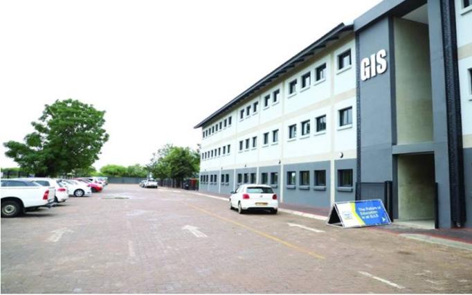
The GIS lab:
In Algeria, the final phase of the National Reforestation Plan (NRP) started on October 1, 2019. The goal is to plant a total of 43 million trees and shrubs throughout the country. According to Ali Mahmoudi, the Managing Director of Forests, the initial phase will focus on planting 25 million plants, while the remaining 17 million will be planted gradually during the campaign, which is expected to last until March 2020.
As of September 2024, Algeria is focusing on enhancing its geospatial capabilities to better manage natural resources and environmental
challenges. The country has begun integrating Geographic Information Systems (GIS) into agricultural practices to optimize land use and improve water management, addressing issues stemming from ongoing drought conditions. Additionally, there are efforts to strengthen the National Spatial Data Infrastructure (NSDI), which aims to improve data accessibility for decision-making across various sectors, including health and urban planning.
The County Government of Nakuru is making significant strides in embracing geospatial technology by establishing a state-of-the-art Geospatial Information System (GIS) laboratory. This initiative, supported by the World Bank, aims to enhance data collection, analysis, and management, ultimately bolstering the county’s development agenda and governance capabilities.
According to the Chief Officer for Lands and Physical Planning, Ms. Stella Mwaura, the new GIS lab is a pivotal move towards digitizing essential services as part of Governor Susan Kihika’s manifesto. The system will enable the county to collect, process, and analyze data in digital form, ensuring a more efficient and cost-effective approach to service delivery. This technological advancement is expected to support both local and foreign investors by providing easy access to accurate land and resource information.
The GIS lab is designed to be a hub for storing and managing a comprehensive digital footprint of development projects across various sectors, including water, education, health, roads, rangelands, environment, and natural resources. The use of geospatial data will play a crucial role in urban
planning, tackling encroachments, and promoting public feedback mechanisms.
Clause 105 (f) of the County Government Act 2012 mandates county governments to establish GIS-based database systems. This will aid in the development of the County Integrated Development Plan (CIDP) and resource allocation for the Annual Development Plan (ADP). By leveraging geospatial technology, Nakuru County is setting a precedent for data-driven governance and transparent decisionmaking processes.
Ms. Mwaura emphasized the importance of geospatial technology in addressing some of Africa’s most pressing challenges, such as unplanned settlements, degraded rangelands, inadequate infrastructure, and inequitable resource allocation. The implementation of GIS technology is a proactive measure to streamline the monitoring of development projects and ensure resources are allocated equitably based on evidence.
Using location-based data collected via satellites, paper maps, and mobile devices, the GIS lab will map out resources and provide critical insights for development planning and resource management. This will empower the county administration to make informed decisions, support prudent resource management, and facilitate rational decision-making processes.
The introduction of the GIS lab is a testament to Nakuru County’s commitment to modernizing its operations and improving governance. By automating service delivery and closing loopholes where public funds might be lost, the county is enhancing efficiency and accountability. The system will also identify areas in need of infrastructure development, such as roads and social amenities, and help streamline the budgeting process based on evidence-
based development needs.
Ms. Mwaura noted that the geospatial data collected will also attract support from development partners by providing a clear picture of the county’s needs and priorities. This technology will help manage resources efficiently and effectively for the benefit of residents, including managing natural resources like forests, water, minerals, and wildlife through developed spatial plans.
In summary, the establishment of the GIS laboratory marks a significant milestone in Nakuru County’s journey towards digital transformation and improved resource management.
By embracing geospatial technology, the county is poised to enhance its development planning and governance, setting a benchmark for other counties in Kenya and beyond.
With the launch of Starlink in Kenya, SpaceX’s satellite internet service is poised to revolutionise connectivity across the country, particularly in underserved and remote areas. This advancement is not just a breakthrough in internet service provision but also has significant implications for the geospatial sector, offering new opportunities for data collection, analysis, and application across various industries.
One of the primary challenges for geospatial professionals in Kenya has been accessing reliable and high-speed internet, especially in rural and remote areas. These regions often lack the infrastructure necessary to support traditional broadband services, which hampers real-time data collection and sharing. Starlink’s satellite-based internet service promises to bridge this gap by providing high-speed, low-latency connectivity, making it possible to deploy GIS technologies more effectively across the country.
For example, surveyors working in remote regions can now upload large datasets directly to the cloud, enabling real-time data processing and sharing with teams located elsewhere. This will enhance the efficiency of projects related to land management, environmental monitoring, and urban planning, and ensure that decision-makers have access to up-to-date information.
Empowering Precision Agriculture and Environmental Monitoring
The availability of high-speed internet in rural areas will be particularly beneficial for precision agriculture, a sector that heavily relies on geospatial data. Farmers can utilize GIS technologies to monitor crop health, optimize irrigation, and predict yields more accurately.
With the integration of Starlink, data from drones and IoT sensors can be transmitted in real-time to centralized platforms for analysis, improving the decision-making process and boosting agricultural productivity.
Furthermore, Starlink can support environmental monitoring initiatives by enabling the deployment of remote sensing technologies in areas that were previously inaccessible due to poor connectivity. Real-time monitoring of wildlife habitats, forest cover, and water bodies can now be carried out with greater efficiency, aiding in conservation efforts and sustainable resource management.
Enhancing Disaster Management and Emergency Response
Kenya is prone to various natural disasters, such as floods and droughts, which can have devastating effects on communities. Effective disaster management and emergency response rely on timely access to accurate geospatial data.
With Starlink, authorities and organizations involved in disaster management can access real-time data even in the most remote and disaster-prone regions.
For instance, during flood events, drones equipped with cameras and sensors can capture highresolution images of affected areas. These images can be quickly processed and analyzed to identify impacted regions, assess damage, and coordinate response efforts. The reliable connectivity provided by Starlink ensures that this critical information reaches the relevant authorities without delay, potentially saving lives and resources.
As Kenya continues to embrace digital transformation, the concept of smart cities is becoming increasingly relevant. Starlink’s highspeed internet can play a pivotal role in supporting
the development of smart city infrastructure, which relies on interconnected devices and sensors to collect and analyze data on urban dynamics.
GIS applications in smart cities include traffic management, waste management, energy distribution, and public safety. With improved internet access, municipalities can implement smart solutions more effectively, using geospatial data to enhance service delivery and improve the quality of life for residents.
The introduction of Starlink in Kenya has the potential to be a catalyst for geospatial innovation, opening up new possibilities for startups and research institutions. With improved internet access, geospatial data can be more readily shared and accessed, fostering collaboration and innovation. This could lead to the development of new applications and services that leverage geospatial data in creative and impactful ways.
For example, startups focusing on remote sensing, location-based services, and geospatial analytics will benefit from the enhanced connectivity, enabling them to reach broader markets and scale their solutions more rapidly.
Starlink’s arrival in Kenya is more than just an improvement in internet service; it’s a transformative development for the geospatial community. By providing reliable connectivity across the country, it empowers geospatial professionals, researchers, and innovators to leverage technology in ways that were previously impossible.
This new era of connectivity has the potential to unlock unprecedented opportunities for data-driven decision-making and sustainable development, propelling Kenya to the forefront of geospatial innovation in Africa.


In the heart of East Africa, a quiet revolution in digital mapping unfolded this September. For the first time in its history, the global State of the Map (SotM) conference, the annual gathering of OpenStreetMap (OSM) enthusiasts, touched down on African soil. Nairobi, Kenya’s bustling capital, played host to this landmark event, showcasing the growing influence of open-source mapping across the continent.
“As
the first African host of the State of the Map conference, Nairobi proved to
be not just a participant in the global OSM community, but a leader in shaping its future.”
OpenStreetMap is a collaborative project to create a free, editable map of the world. Think of it as the “Wikipedia of maps,” where anyone can contribute their local knowledge to improve the global dataset. This open approach has made OSM particularly valuable in areas underserved by commercial mapping services.
From September 6-8, 2024, over 200 participants from around the world gathered at the University of Nairobi Towers. The diverse crowd included local mappers, international OSM veterans, NGO representatives, and tech industry leaders, all united by their passion for open-source mapping.
The three-day program was a whirlwind of knowledge-sharing and collaboration:
• Day 1 kicked off with a grand opening, setting the stage for OSM’s global impact.
• Day 2 shone a spotlight on African mapping initiatives and technical innovations.
• Day 3 brought a scholarly twist with a dedicated academic track.

Throughout the conference, breakout rooms buzzed with impromptu discussions and planned sessions, fostering deeper connections within the community.
2. Walter Mayeku and Mary Muthee highlighted the growth of Kenya’s OSM community.
3. Tanzania’s Benedcto Adam introduced an innovative approach to data collection using customized tricycles.
4. Luis Sebastian Bravo Chacon demonstrated OSM’s role in tropical forest conservation.
5. Enock Seth Nyamador provided a candid look at OSM’s challenges and triumphs in Ghana.
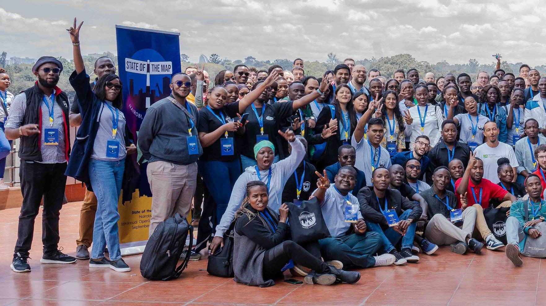
The heart of the conference beat strongest when showcasing African innovation. Presentations from across the continent demonstrated OSM’s real-world impact:
1. Zacharia Muindi and Laura Mugeha shared strategies for engaging high school students in mapping.
“These sessions not only illustrated the practical applications of OSM but also emphasized the importance of local knowledge in creating accurate and meaningful maps.”
Tech Talks and Community Building
The conference wasn’t just about showcasing current projects. Cutting-edge technical discussions pointed to the future of OSM:
- Sajjad Anwar and Wille Marcel explored cloudnative OSM for advanced visualization and analysis.

- Markus Tremmel introduced next-generation vector tile formats tailored for OSM data.
- Erick Mnyali discussed integrating OSM into Tanzanian academic curricula.
Diversity and inclusion took center stage in sessions like Anastazia Caroll’s “Women in OSM Tech,” addressing the critical need for representation in the tech community.
Sunday’s academic track added a scholarly dimension to the proceedings. Researchers presented on topics ranging from the socioeconomic impact of open mapping in developing countries to novel geospatial data analysis techniques.


Panel discussions tackled the hurdles facing OSM in Africa head-on. Limited internet access, the need for localized training materials, and volunteer engagement strategies were all on the table. Yet, the overwhelming sentiment was one of optimism, with participants recognizing OSM’s potential as a tool for development and disaster response.

It wasn’t all serious business. Social events at the University Balcony and Baobox provided much-needed relaxation and networking opportunities, forging connections that span continents.
As the conference wrapped up on September 8, the excitement was palpable. State of the Map Nairobi 2024 will be remembered as a watershed moment for OpenStreetMap in Africa. By bringing the global OSM community to the continent and showcasing homegrown innovations, the conference has set the
stage for increased African leadership in the open-source mapping world.
“The success of SotM Nairobi not only highlighted the vibrancy of the African OSM community but also reinforced the truly global nature of the OpenStreetMap project.”
From grassroots initiatives to cutting-edge tech and academic research, the conference demonstrated the multifaceted nature of the OSM ecosystem. As attendees departed, inspired and energized, one thing was clear: the future of open-source mapping in Africa is bright, and its impact will be felt far beyond the continent’s borders.


“Africa’s mappingopenfuture shines guidingbright, a communityglobal forward.”
By David K.
Urban planning in Kenya has faced significant challenges over the years, with various socio-economic, political, and environmental factors making the process complex.
These findings highlight various dimensions of the problem, including poor governance, informal settlements, inadequate infrastructure, financial constraints, and environmental pressures. Below is a comprehensive exploration of why urban planning has been a difficult task in Kenya, as per the UN-Habitat’s findings.
One of the most significant challenges identified by UN-Habitat is the rapid rate of urbanization in Kenya. The country’s urban population has grown tremendously, with cities like Nairobi, Mombasa, Kisumu, and Eldoret experiencing significant population booms. This rapid urbanization often outpaces the government’s capacity to plan and provide for urban residents, leading to overcrowding and strained urban systems.
The UN-Habitat report emphasizes that the rate of urbanization in Kenya is occurring without corresponding development in infrastructure, housing, and public services. Informal settlements, such as Nairobi’s Kibera and Mukuru, have
become emblematic of this issue, where a lack of proper urban planning has resulted in slums with inadequate sanitation, housing, water supply, and health services.
A large proportion of urban dwellers in Kenya live in informal settlements. According to UN-Habitat, more than 50% of Nairobi’s population resides in slums, which are unplanned and often lack basic services. These settlements are largely the result of inadequate affordable housing options for the low-income urban population.
Urban planning efforts are further complicated by the fact that informal settlements exist outside the formal land and housing markets, making it difficult for authorities to regulate and improve living conditions in these areas. The mushrooming of these settlements is often driven by rural-to-urban migration, where people flock to cities in search of better livelihoods but are unable to afford formal housing.
Additionally, efforts to upgrade or relocate residents from these informal settlements face resistance due to the deep-rooted social networks and the economic ecosystems that thrive in these areas. As a result, urban planning efforts in these areas have been limited and often unsuccessful.
Kenya’s infrastructure, including transportation, water supply, sanitation, and electricity, has struggled to keep pace with the growing urban population. According to UN-Habitat, the lack of adequate and coordinated infrastructure planning has led to congestion, inadequate waste management, and limited access to clean water and reliable electricity in urban centers.
Public transportation systems in cities like Nairobi are overwhelmed, leading to traffic congestion, high levels of pollution, and lost productivity. UN-Habitat notes that without coordinated planning for transportation networks and other critical infrastructure, urban centers in Kenya will continue to struggle with poor connectivity and inefficiencies.
The lack of access to basic services such as clean water and sanitation is another pressing issue. Many informal settlements have inadequate sewage systems, leading to public health risks. Water scarcity, coupled with insufficient distribution networks, means that many
urban residents rely on informal vendors, further complicating the situation.
Effective urban planning requires strong governance structures and institutional capacity, both of which have been lacking in Kenya. UN-Habitat’s findings point to weak governance systems at both the national and county levels, characterized by inefficiency, corruption, and poor coordination between different government agencies.
The devolved governance system in Kenya, introduced by the 2010 Constitution, was intended to improve service delivery and planning at the county level. However, many counties lack the technical capacity and resources to effectively carry out urban planning tasks. In many instances, county governments do not have updated urban plans or the expertise required to implement them, leading to poorly managed urban development.
Corruption also plays a major role in the failure of urban planning. There are numerous instances where land meant for public use has been illegally allocated to private developers, undermining the efforts to create well-planned urban spaces. Land grabbing, illegal settlements, and unregulated construction are rampant, further complicating urban planning efforts.
Urban planning and development are capitalintensive undertakings, requiring substantial financial investment. Kenya faces significant financial constraints that limit its ability to implement comprehensive urban plans. The UNHabitat findings highlight that much of the urban development in the country is underfunded, with inadequate budget allocations for critical sectors such as housing, infrastructure, and public transportation.
The private sector has been a significant player in urban development in Kenya, but much of this development has focused on high-end markets, leaving low-income and informal settlements underserved. Public-private partnerships, which could be a solution, have been underutilized, partly due to mistrust between the government and private entities, as well as the lack of clear frameworks for collaboration.
Moreover, Kenya’s dependence on external funding for many urban development projects poses another challenge. Donor funding is often tied to specific conditions and timelines, limiting the flexibility of local authorities to implement long-term urban planning initiatives that would meet the needs of a rapidly growing urban population.
Environmental degradation and climate change pose additional challenges to urban planning in Kenya. According to UN-Habitat, many urban centers in Kenya are already facing the effects of environmental stress, including deforestation, air and water pollution, and the loss of green spaces.
Urban areas are particularly vulnerable to the impacts of climate change, including flooding, droughts, and rising temperatures. Nairobi, for example, experiences frequent flooding due to inadequate drainage systems and the encroachment of settlements into floodplains. Climate change adaptation measures have been slow to take root in Kenya’s urban planning efforts, leaving cities ill-prepared to cope with the long-term impacts of environmental change.
Politics heavily influences urban planning in Kenya, often leading to outcomes that prioritize the interests of influential individuals or groups over the broader public good. Politicians and powerful figures can manipulate planning processes to benefit themselves or their allies, which can result in several adverse effects:
1. Uncoordinated Development: Political interference can lead to fragmented and uncoordinated urban development. Projects may be approved based on political considerations rather than their alignment with long-term urban planning goals, resulting in inconsistent development patterns that lack coherence.
2. Illegal Developments: In some cases, political influence can lead to the bypassing of legal and regulatory frameworks. This includes the approval of developments in areas designated for other uses or on land without proper title deeds.
Such practices undermine formal planning processes and can lead to problematic land use and infrastructure issues.
3. Corruption and Favoritism: The intersection of politics and urban planning can foster environments where corruption thrives. Favoritism and nepotism in awarding contracts or approving projects can divert resources from needed developments and inflate costs.
Bureaucracy also presents significant challenges to urban planning in Kenya. The inefficiencies in the planning and approval processes contribute to delays and discourage investment in formal housing and infrastructure:
1. Lengthy Approval Processes: The urban planning approval process in Kenya can be extremely timeconsuming. Developers often face delays due to a slow-moving bureaucratic system, which includes multiple layers of approvals and reviews from various governmental bodies.
2. Conflicting Regulations: The lack of uniformity in regulations and standards across different jurisdictions creates confusion and obstacles for developers. Conflicting regulations and requirements can lead to inefficiencies and inconsistencies in the development process.
3. Unclear Land Tenure Systems: Uncertainty and disputes over land tenure are prevalent issues. Ambiguities in land ownership and title deeds contribute to delays and disputes, further complicating planning and development efforts.
Conclusion
Kenya’s urban planning faces challenges, but through stronger governance, public-private partnerships, and climate-smart strategies, the country can achieve sustainable development and improve living conditions for its rapidly growing urban population.

Elevate your brand to new heights by aligning with Afrospatial Magazine, your gateway to the pulse of geomatics innovation worldwide! As we celebrate our inaugural issue, we are offering special advertising packages designed to boost your company’s visibility. Act now to unlock unique opportunities and connect with the global geospatial community.
Contact us today! +254 741 609234 or email us on marketing@afrospatial.com
Across
2. The East/West component of a location on the surface of the Earth
4. A map containing geographic features that is used for reference. Roads, for example, are commonly found on base maps
9. Data type comprised of x-y coordinate representations of locations on the earth that take the form of single points, strings of points (lines or arcs) or closed lines (polygons) known as features
10. The p rocess of identifying a question or issue to be addressed, modeling the issue, investigating model results, interpreting the results, and possibly making a recommendation.
12. The north/south component of a location on the surface of an ellipsoid
13. A set of parameters and control points used to accurately define the three-dimensional shape of the Earth
14. The process of identifying the coordinates of a location given its address
1. Data about the content, quality, condition, and other characteristics of data
3. The parallel of reference 0 North or South
5 A characteristic of a feature in a Geographic Information System (GIS)
6. The horizontal direction of a vector, measured clockwise in degrees of rotation from the positive y-axis, for example, degrees on a compass
7. In a GIS, a physical object or location of an event Features can be points (a tree or a traffic accident), lines (a road or river), or areas (a forest or a parking lot)
8. A series of satellites that produce images of the Earth
11. A cellular data structur e composed of rows and columns for storing images
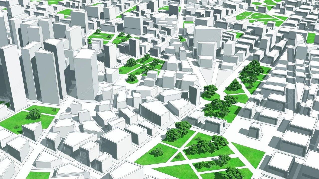
By Gerald Nyanjua
Contemporary Architecture has evolved due to advances in technology over the past decades in both Architecture and the built environment professions, including landscape architecture and urban planning.
One of the most influential innovations is 3D mapping, which is a tool that can provide detailed threedimensional models of spaces, environments, and objects.
It is now a common tool in Design, Planning, and Visualization, which aids Architects, Landscape Architects, and Urban Planners in making better evaluations of various spatial data for enhanced designs, efficiency, and aesthetic value. The use of 3D mapping in the context of architecture, landscape architecture, and urban planning has been discussed in detail in this article, including the possible utilizations, advantages, and future trends of 3D mapping.
In architecture for example, 3D mapping has shown to be a useful tool in coming up with ideas and how the ideas can be implemented. Architects and Designers are not limited to sketching and drawing plans on paper; they employ 3D mapping to model structures and buildings precisely. Using these models, an architect is in a position to analyze the structural form from
different dimensions: perceived flaws, strength, and beauty.
Today, through the help of 3D maps, architects can virtually tour the building before the structure is built. They benefit clients by giving them a perspective on the design and letting them visualize spaces to make choices.
This avoids confusion and makes sure the client’s expectations match the final output produced by the company. Autodesk’s Revit and Google Sketch Up are some of the most commonly used applications in the architectural design process to develop elaborate models that mimic real-life conditions.
However, 3D mapping is not just used in the visualization of projects but in the physical construction as well. By employing BIM technology, architects and construction teams can design construction plans, organize the construction process, and monitor the construction progress through 3D maps. It refers to the process of capturing spatial and material data, which helps various teams to better coordinate resources and minimize failures in construction.
The physical shapes of buildings or existing structures can be brought into digital models using laser scanning and LIDAR technologies.
This is most helpful in new construction, renovations, and additions to existing structures. This is important because the high accuracy of 3D mapping guarantees that new designs fit well into the existing environment.
With the increasing emphasis on sustainability in contemporary architecture, 3D mapping assists architects in designing energy-efficient buildings. Some digital tools can also mimic climatic conditions such as sun exposure to help architects adjust and enhance the natural lighting and air ventilation. These simulations help to make sure that a building uses less energy and in turn, makes a small impact on the environment.
3D mapping is a significant aspect of Landscape Architecture mainly because it involves mapping the site to help analyze the terrain, water systems, and vegetation layouts during the design phase. In the past, landscape architects were limited by maps and site Plans in understanding the physical features of a site. Nevertheless, 3D mapping offers enhanced and detailed analysis of features like topographical variations, slopes, water flow, and type of soil present in a site.
Techniques like GIS and Photogrammetry are used in Landscape Architecture to design precise topographical maps. Such maps therefore enable landscape architects to come up with land designs that correlate with the existing land features, thus ensuring that new developments are both compatible with the land rather than being invasive.
The primary role of landscape architecture among other objectives is to design a pleasing and useful outdoor environment. Landscape Architects are frequently able to create these spaces in any weather and different seasons and years down the line as plants grow about the area using 3D mapping.
This forward-looking approach means that designs remain visually appealing and sustainable for many years. For instance, a professional designing an urban park and public garden can model it in 3D and easily try out different plant locations, paved areas, or water bodies.
Due to the possibility of manipulation, the created 3D maps allow landscape architects to think through multiple choices and assign the best possible configurations that will help to make the use of space more effective and eco-friendly.
The theme of sustainability is very much relevant to the profession of landscape architecture and 3D mapping is crucial in reducing harm to the ecology. In consequence, landscape architects can employ LIDAR and drone-based technologies to map ecosystems and simulate how new designs will affect habitats, water systems, and vegetation in the area.
The information provided thus assists the different professionals in planning and forecasting erosion control, storm water management, and preservation of the habitats. For instance, with 3D maps, sustainable green infrastructure strategies that include bio swales, rain gardens, and green roofs can be developed efficiently. These designs assist in addressing issues such as storm water runoff and heat island effect, thereby enhancing the sustainability of cities.
The potential of 3D mapping in urban planning focuses on the arrangements and control of the human settlement and development of space and resources in towns and cities. 3D mapping is crucial for contemporary planning as it helps to design city layouts and assess the effects of new constructions on urban environments.
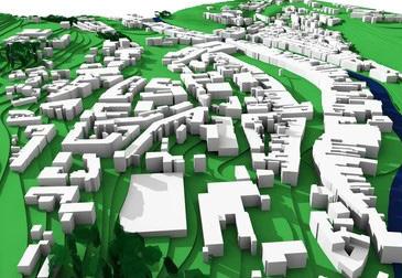
When it comes to Planning and Architectural Design, the application of 3D models helps in determining heights, density, and the type of use of structures in the larger city. It assists organizations in making zoning choices to guarantee compliance with the general
structure of the city. Where space is scarce as is the case with many urban centers, 3D mapping is especially useful when it comes to planning activities in areas where different types of development are being planned in a given piece of land.
Infrastructure is the foundation of any city and 3D mapping provides urban planners with a strong support system to address roads, bridges, public transport, and utilities. Applying 3D map data in GIS, Urban Planners can detect congested places, estimate the significance of new road topologies, and design more effective transport systems. This helps improve traffic flow, reducing traffic jams, and increasing mobility of the public.
In addition, the technique of 3D mapping helps urban planners to evaluate and renovate old structures in a better way. For instance, using 3D laser scanning, cities can accurately assess where underground utilities are and develop maintenance or expansion plans easily. There is greater emphasis on public participation in the planning process and the public has a more active role in the development of the city.
3D mapping is the most helpful for the public since it allows them to visualize the proposed plans and developments. Utilizing virtual reality and 3D visualization tools enable Urban Planners to show concepts to the people in an efficient manner.
It makes it possible for the citizens to ‘physically’ visit new developments and see how they move around, the public areas, and the changes that will be brought about to the areas they live in. This helps in developing participatory decisionmaking since the recipients of the development solutions such as residents, developers, and local government can collectively make decisions on sustainable development solutions.
In the following years as the Urban Environment transitions to smart environments where Information Technology complements the city structures, 3D mapping is going to become paramount. All the traffic within the city, smart buildings, and even power usage can be
done using 3D maps with the help of the IoT (Internet of Things). Therefore, the integration of elements of 3D modeling with data analysis is advantageous in improving the functionality of smart cities.
3D mapping is the key to developing smart city surveillance in Singapore and Dubai for sustainability, security, and effectiveness. These plans are the future of how cities are going to be developed where they can switch up to fit the people residing in the area, as well as the surrounding environment. They are some of the areas where technologies like 3D mapping exist and are transforming how Architecture, Landscape Architecture, and Urban Planning are being accomplished.
In any case - when it comes to discussing the construction of energy-efficient structures and landscaping or the concept of small cities, 3D mapping regulations provide clarity and visualizations.
Because all segments of society are calling for sustainable, resilient, and habitable environments, 3D mapping will still be relevant. It points to the professionals where to focus the planning and designing for the current one and where to seek how to address the next barriers. Given the modern tendencies for urbanization, 3D mapping remains one of the most widely used and valuable enabler solutions in constructed environments.
This article clearly and concisely describes how 3D mapping is inserted into and within Architecture like Architecture, Landscape Architecture, and Urban Design. All of these sections give examples of addendums of the mentioned technology; various applications, current applications, and possible future applications.